Sigeion
Çanakkale · Archaeological site
Photo: Fulcran Vigouroux · Public domain
Catalogue label
- Type
- Ancient city
- Kind
- Archaeological site
- Province / district
- Çanakkale
- Elevation
- 57 m
- Wikidata
- Q1583181
About
Sigeion (Ancient Greek: Σίγειον, Sigeion; Latin: Sigeum) was an ancient Greek city in the north-west of the Troad region of Anatolia located at the mouth of the Scamander (the modern Karamenderes River). Sigeion commanded a ridge between the Aegean Sea and the Scamander which is now known as Yenişehir and is a part of the Çanakkale district in Çanakkale province, Turkey. The surrounding region was referred to as the Sigean Promonotory, which was frequently used as a point of reference by ancient geographers since it marked the mouth of the Hellespont. The outline of this promontory is no longer visible due to the alluvial activity of the Karamenderes which has filled in the embayment east of Yenişehir. The name 'Sigeion' means 'silent place' and is derived from Ancient Greek σιγή (sigē), 'silence'; in Classical Antiquity, the name was assumed to be antiphrastic, i.e.
Text: Wikipedia, CC BY-SA 4.0 · Read more on Wikipedia
Location
Visiting here? The next 5 places nearby
The best-known places close by, in the shortest order from Sigeion: about 47 km and 45 min of travel, plus roughly 7 h 30 min for the visits.
8.1 km · 8 min by car
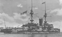 HMS Majestic
Çanakkale, Eceabat ilçesi
2.3 km · 2 min by car
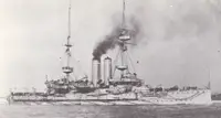 HMS Goliath
Çanakkale, Eceabat ilçesi
13 km · 13 min by car
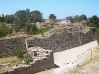 Troy
Çanakkale
15 km · 15 min by car
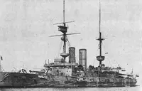 HMS Irresistible
Çanakkale
8.6 km · 9 min by car
 Dardanos
Çanakkale
Directions for this routeDistances are straight-line estimates adjusted for roads; check each museum's hours before you go.
Also nearby
- Temple of Athena at Ilion · 6.1 km
- Hisarlik Hill · 6.2 km
- Bouleuterion (Troy) · 6.2 km
- 1915 Seddülbahir Ahmet Uslu Müzesi · 6.2 km
- 1915 Seddülbahir Ahmet Uslu, Savaş Materyalleri Müzesi · 6.2 km
Wrong information?Tell usFix it on OpenStreetMap