Nagidos
Mersin, Bozyazı · Archaeological site
Photo: Nedim Ardoğa · CC BY-SA 4.0
Catalogue label
- Type
- Archaeology
- Kind
- Archaeological site
- Province / district
- Mersin / Bozyazı
- Elevation
- 60 m
- Wikidata
- Q1963565
About
Nagidos (Ancient Greek: Νάγιδος; Latin: Nagidus) was an ancient city of Cilicia. In ancient times it was located between Anemurion to the west and Arsinoe to the east. Today its ruins are found on the hill named Paşabeleni at the mouth of the Sini Cay (Bozyazı Dere) near Bozyazı in Mersin Province, Turkey. It lies at a distance of ca. 20 km to the east of Anamur. Like its eastern neighbor Kelenderis, it was a colony of Samos. The small island of Nagidoussa is opposite Nagidos; on it are the ruins of an Ottoman fortress.
Text: Wikipedia, CC BY-SA 4.0 · Read more on Wikipedia
Location
Visiting here? The next 5 places nearby
The best-known places close by, in the shortest order from Nagidos: about 166 km and 2 h 45 min of travel, plus roughly 7 h 30 min for the visits.
44 km · 44 min by car
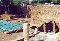 Kelenderis
Mersin, Aydıncık
39 km · 39 min by car
 Arsinoe
Mersin
16 km · 16 min by car
 Mamure Castle
Mersin, Anamur
15 km · 15 min by car
 Anemurium
Mersin, Anamur
53 km · 53 min by car
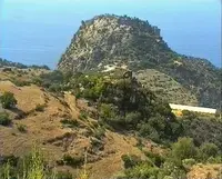 Antiochia ad Cragum
Antalya, Gazipaşa
Directions for this routeDistances are straight-line estimates adjusted for roads; check each museum's hours before you go.
Also nearby
- Softa Castle · 3.5 km
- Anamur Museum · 11 km
- Mandane · 12 km
- Titopolis · 15 km
- Myus · 29 km
Wrong information?Tell usFix it on OpenStreetMap